Local Motion - New Brunswick

Welcome to Local Motion where we celebrate hiking, biking, camping, paddling, skiing, and exploring in Southern New Brunswick.
Showing posts with label bike routes. Show all posts

June 18, 2010

Riding the Corn Hill Countryside

Speeding past green fields on empty roads.

Last night three friends and I went for 18 km bike ride on the rolling country roads around Corn Hill. We packed a picnic and headed west on Route 890, swinging back east on the Buckley Settlement Road to climb up Anagance Ridge. We stopped for our light supper at the edge of a cattle pasture overlooking Corn Hill. We finished our loop along the Country View Road where we enjoyed wide views, to the east and west, as we sped on the smooth pavement at top speed. We moseyed back to the house, riding side by side on the empty roads, enjoy the last of the sunlight on this warm summer night. 


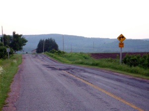
On the Elliot Road.

Riding side by side on empty roads.
Corn Hill Bicycle Festival bicycling biking bike new brunswick moncton saint john sussex petitcodiac graham waugh local motion

June 15, 2010

Bicycling in Corn Hill


Just got back from a great evening ride around Corn Hill. The sun was starting to set as I left the driveway with my Dad. We headed around block, as its known, and had only 2 cars pass us the whole time. A rainstorm in the afternoon had left the land laden with moisture and as it began to cool pockets of mist formed in sheltered corners. 

There always seem to be something interesting happening with the weather around here. The summer clouds are remarkably dynamic in Corn Hill creating powerful sunset over the open hills and in the early morning light you’ll find fog lying in the valley floors after a warm summer night.

If you're interested in cycling in Corn Hill check out the Corn Hill Bicycle Festival - 

www.bicyclecornhill.wordpress.com

 Riding by green fields


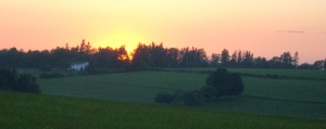
Sunset over the Baseline Road
 
Looking over the gap at White’s Mountain


Pockets of mist in the forest
 corn hill local motion new brunswick sussex moncton saint john outdoors adventure cycling biking bicycle summer hikes graham waugh corn hill bicycle festival

August 6, 2009

Ride and Climb on the Kingston Peninsula

My two wheeled, ten speed "escape hatch" from the city

Nothing better than leaving for an adventure straight from work! This evening was a couple weeks ago on a hot day in July. I had my backpack ready to go with some basic climbing gear, warm clothing, and snacks so that by 5 pm I could hit the road. I wanted to bicycle instead of drive to meet my friends Lucas and Kristy at a favorite after work crag near Reed's Point on the Kingston Peninsula across from the Gondola Point Ferry terminal.

Shortly after leaving uptown where I work I crossed the transcanada highway and I got lost, having navigate by feel until I met up with a familiar road farther north. I was bound for the Summerville Ferry that crosses from Millidgeville, just north of Saint John, to the Kingston Peninsula. As I pulled up I passed a line of cars that had been anxiously waiting for the ferry. At busy times of the day car drivers sometimes have to wait for the next boat....not bike riders though! I enjoyed the luxury of boarding and unloading ahead of all the cars. On the ferry I had a few minutes to relax and enjoy the sun glistening over the Kennebecasis River.

On the Kingston Peninsula I rolled through quiet backroads. On my way to Reed's Point I met more barns than cars and got into a good flow rolling hills. The interesting views on this ride occured less often than I expected. The road mainly passes through a thick forest but a there are a handful of panoramic views over the Kennebecasis. And the scenic highlight of the trip occurs just before the descent to Reed's Point. Views are good but I'm not chasing those. The fleeting images I catch as I'm pedalling hard, with my mind focused, are always more memorable.

The road leading down to the Gondola Point Ferry Crossing

I rolled up to the Crag at just before 7 pm. The riding time probably only added up to just over an hour while getting lost and taking the ferry made up the rest of the hour. The crag, which we can Gondola Point, ( although its not in Gondola Point) is set down just below the road on the edge of the Kennebecasis River. It's a great spot to unwind at the end of the day. There are a few great, through short, sport climbing routes. This includes one that has 20 feet of delicate stemming (picture an being inside an open faced book) and another that traverses an overhanging wall over the water!

What a great summer night!

Lucas leading a DeerJaw 5.10 with Kristy on the belay


Lucas Leading MooseJaw 5.10 with the Kennebecasis River in the background


Details:
Where: Kingston Peninsula, near Saint John
Distance: 30 km (oneway) from Uptown Saint John to Gondola Point Ferry.
Directions: See Google Maps below. It's a straight forward route once you reach the Ferry. To get there I went on Somerset Street and Milledgeville Avenue but you'll have to take whatever streets make sense from your origin. Once you're on the Kingston Peninsula, there are no turns to make. Just stay on Route 845 following signs to Gondola Point. The climbing area is approximately 1000 feet before the Reed's Point/Gondola Point Ferry Terminal. There is a small roadside pull out on the water side of the road across from a wet 15 foot cliff. From the roadside pull out, facing the water, head left 30 ft to a steep trail that loops around to the cliffs. The cliffs are directly below the roadside pull out.
Roads: Good condition overall. Some sections are better than others. The surface is mostly pavement with areas of chip seal. (Chip seal is common on backroads. It is tar with rock on top with makes it rougher than pavement) Not many pot holes. Cracks are common yet easily avoidable.
Terrain: Rolling hills with just a couple bigger ones.
Road Conditions: Varied new and old pavement, but overall old 2 lane road with no shoulder. Potholes, cracks, and pavement patches in many places but easy to navigate around.
Traffic: Very little traffic. I was given lots of space by drivers.
Services:
There are a couple Convenience Stores along the way.
graham waugh, local motion, saint john, new brunswick, kingston peninsula, cycling, biking, bikes, outdoors, active living, rock climbing

View Larger Map

July 20, 2009

Ride to the Headwaters Sum-Up

Was it a success? I think this photo sums it up. I snapped it on the flat stretch coming into Corn Hill just a couple miles from home. All in all, a perfect ride. A hundred and some kilometers in about 5 hours. No flats, no breakdowns, good pavement, great views, plenty of water, and a new sense of how compact Southern New Brunswick is.


Smiling on the final stretch into Corn Hill

I realized as I left my appartment in Saint John at 2 pm, that I was nervous. I thought, this is good. It means I'm doing something beyond my comfort zone. Raindrops made me hesitate as I crossed the Courtney Bay causeway but I carried on. It was a boring ride through Loch Lomond and traffic was steady until I passed the airport. I am blown away by the size of Loch Lomond (the lake). I stopped to drink some of its water that I had brought from my tap at home.

After that it was quiet back roads through Upham, Upperton, Hillsdale and all the way to Hammondvale. I followed the Hammond River past fresh cut Hay fields and cow pastures. This was a very mellow and peaceful section of biking. I used this opportunity to snack on carrots and trail mix that filled my pockets. As I turned toward Sussex Corner I crossed the Hammond River for the last time and began a section of big fast hills. Hills so long that on the way down you reach terminal velocity.

And old barn in Hillsdale with one summit of Saddleback Mountain in the background


Looking over spokes at the community at farm country near Sussex Corner


Wide open fields near Sussex Corner

I made it to Sussex Corner, hooped and hollered to myself, then swung through downtown to get water at Winter Wood Natural Foods. Being on my bike for the first time in Sussex it occured to me that this is a perfect town for day to day biking. Its completely flat and relatively compact.

The last section of biking, Sussex to Corn Hill, I knew would be the toughest. Not only because I was getting tired but because its got lots of hills.

Hesitant rain started falling as I left Sussex but it wasn't enough to slow me down. Once you get moving on a bike its psychologically hard to stop. After a few kilometers the rain stopped and the warm wind dried my shirt. I past more freshly cut Hay fields, big barns, and front yard vegetable gardens. My pedalling slowed on the straight aways and now I was for the first time using the easiest of my ten speeds on most of the hills. With about 12 kilometers to go I decided it was time to pull out my secret weapon...Sauerkraut! I ate a few mouthfuls of my homemade energizer and life flowed back into my legs. I'm not sure what it is about homemade fermented sauerkraut but it gives a huge rush of nearly hyperactive energy.

Looking west down the valley towards Sussex


The last hill, the killer, just before pulling into my parents' driveway

My dad biked out to join me for the last kilometer and together we sped our way up the final hill which just also happens to be steepest hill of the entire route! And as we turned into my parent's drive way, it started to rain. Which is a fitting way to end the journey to the top of a watershed. That night we enjoyed a delicious meal from my parents' organic vegetable garden, topped off with homemade strawberry ice cream from their garden's final berries.

Good Food from the Garden at my folks' place
local motion, graham waugh, bicycling, new brunswick, sussex, saint john, cycling, bike, birthday challenge

July 16, 2009

Ride to the Headwaters - mini Birthday Challenge

Biking the backroads of Southern New Brunswick

Looking across the Saint John - Petitcodiac Watershed Divide in Corn Hill

This afternoon, for my mini Birthday Challenge (the real deal is the Fundy Trek), I'm bicycling from my house at the Mouth of the Saint John River to the Headwaters of one of it major tributaries, the Kennebecasis River. I grew up in Corn Hill which forms the watershed divide between two of New Brunswick's famous rivers- the Saint John and the Petitcodiac. A good birthday challenge should provide some reflection. As a kid I was obsessed with the creeks near our house, the puddles in our driveway, and even a good rainstorm. So for my 24th birthdday it's fitting to retrace my path through the river network back to Corn Hill.

Since I'm dedicating my ride to water I thought I'd start by tracing the taps from my house back to their source at Loch Lomond in East Saint John. Beyond this I'll continue through Barnesville, Upham, and Hillsdale following the beautiful Hammond River Valley (http://www.hraa.ca/). Near the community of Hammondvale I'll part with this river and head towards Sussex Corner, joining Trout Creek shortly, before I leave Sussex and begin to follow Smiths Creek to Corn Hill.

While watersheds collect and concentrate the rain, our backroads reflect century old carriage paths that took people and their goods from farm to village to town and city. From the hinterlands of the Kennebecasis Watershed, people for thousands of years have walked and floated downstream to Saint John. These age old paths are now paved and impersonal but they can be tamed once again on foot or bike.

I love hearing the old stories of farmboys from Corn Hill biking the 25 km into Sussex for a Friday night dance then biking home again in the wee hours of the night. Although I doubt it would be much fun to ride a single speed bike on those bumpy old dirt roads, the idea of riding my bike get somewhere is very appealing. Biking home today is about more than just a physical challenge, I frankly need to get home. Its my Dad's big 60th birthday party on Saturday and I have a whole day of work to our place ready for it!

As my friend Ross often reminds me, human bodies evolved for motion. We can walk and run more efficiently than any other land animal. And the invention of the bike in the early 1800's increased the efficiency of our human potential once again. Last night I got a lesson on bike mechanics from my friend Lucas, the bike mechanic, as he fixed up my old Nishiki road bike on his backdeck. It's been a couple years since I pedalled 100km. I'll see how it feels to be an efficient human...probably painful :)
graham waugh, local motion, biking, bicycling, cycling, birthday challenge, corn hill, sussex, saint john, kennebecasis, hammond river,


View Larger Map

July 14, 2009

Ride and Hike to Green Head

The Cliffs of GreenHead


The other night I was looking for an evening bicycle ride and remembered hearing about cliffs at Green Head, Near Dominion Park, in Saint John West. The ride was just what I needed. An hour on my bike and a 2 km hike with a dash of exploring.

I packed some things, a sweater, some water, my headlamp, and a clif bar, then hit the road. I pedaled down Harbour Passage, enjoying the smooth red pavement, then climbed over the hill to the Reversing falls Bridge. After a couple simple turns to the North, I crossed the tiny bridge and found myself on the Rectangular Island that faces into Grand Bay.

When exploring a new area I like to bike to the end of roads so that I can develop a mental map of the place. So I followed the main road, soon arriving at Dominion Park Beach. The beach was not my scene. 'Man Trucks' blared crappy radio rock in the parking lot, while people slammed back pop from the canteen. No cliffs in sight. I turned to the remaining road on the island, climbed a steep hill on my bike and came across a woods road that went North. (On google maps this is labeled as an extension of Greenhead Road.) This road has been blocked off with a few large boulders. Eager to find some wilderness and knowing there was still a lot of Island left to the North, I stashed my bike and started hiking.

I followed this straigt forward ATV road for 2 km, admiring the big old forest, and soaking up spectacular views from a powerline clearing on the highland. Big forested hills rumpling into the sparking water, reminding me of hiking along the Saanich Peninsula, just north of Victoria, BC. The road ended at a small cove that was backed by tall limestone cliffs. I was blown away by the rugged landscape. The site has been a quarry once and bizarre formations remain.

I scrambled up scree slopes and walked along narrow limestone ridges that reminded me of hiking in the Canadian Rockies near Canmore. The rock was identical. The cliffs were tall and held some potential for rock climbing. Though, like I had heard the most impressive face, 100 ft of slightly overhanging blank rock, was nearly completely blank. The bulk of it was devoid of cracks and holds. But beautiful in its own right. The 50-60 foot rambling cliffs on either side of the big face could hold easier sport routes. And I did see the potential for a line through a large flake that would only require a couple bolts to protect the top third. If quarrying had taken place on this face, then nature had hidden the scars. The rock was clean and weathered.

The MainFace, big, intimidating, and seriously lacking hand holds.

I ran into a young couple that regularly enjoying hike in the area. They informed me that the cave, up on the cliff, was at least 100 ft deep and was a popular spot for caving. These two carried on to scramble up one of the cliffs.

This area is also a popular party spot with empty beer bottles in abundance. In my experience, Moose Light is the number one beer bottle tossed in the woods (Coors light cans are close behind). I wonder why this is? Apparently Moosehead has the bush-party/camp market cornered in New Brunswick. Is it the "wild" or "nature" appeal of the name "moosehead"? And why do these manly outdoors men drink "Light" beer? This was the case on Turtle Mountain. The tough guys in their loaded Jeeps, who spray painted naked women on the cliffs, handed us bottles of Moose Light as they drove off the Mountain. I wonder if Moosehead, who is a proud community partner for many events, realizes that its product is often left as trash in the woods?

I soaked up the last of the warm sun from a mini ridge line, overlooking the sparkling bay, banked by countless layers of mountains in the distance. Lots of people enjoy this natural space. Even the ones who leave their garbage behind. I'm glad they use it. We all need some wild in our lives. But what has caused them to accept leaving trash behind? This gives me something to to think about on the ride home.

Local Motion, graham waugh, hiking, saint john, dominion park, green head, cycling, biking routes, cliffs, rock climbing, explore, exploring, road rides,
----------------
DIY

Where: Saint John West
Distance: 9 km (oneway) from Uptown Saint John to trail head. 2 km (oneway) along ATV trails to cove and cliffs.
Directions: See Google Maps below. From Uptown take Harbour Passage and the Reversing Falls Bridge. Veer Right at Simms Corner, then right again onto Manawagonish Road, and right onto Church Street, and right again onto Greenhead Road. Pass the prominent Church, go down the long hill, cross the small bridge, and keep right on Greenhead Road. Climb to the top of the short hill. This road loops back around to Dominion Park Beach.
The trail head, is marked on the map by the white circle. It is at the top of the hill, directly across from a house. It is marked by a few big stones to keep traffic out. On this trail, stay on the main path. There are couple small side trails, but its obvious that these are not used as much. At the power lines follow the trail to the left and down the big hill. The hike climbs and descends several hills but is relatively easy.
Roads: It's a straight forward route, requiring a minimum of city riding, despite being through the city. Smooth pavement for most of it. Harbour passage is easy to ride and there is a section, though short, of bike lane on Church street. This route is easy to navigate on the way to Green Head because it is all right hand turns.


View Larger Map

July 9, 2009

Mellow Pedaling to Mispec

We are pretty lucky in Saint John to have so many back roads cutting across a range of landscapes. From the rolling river valley to the Bay of Fundy, cycling provides a great way to experience the regions unique character. Recently I've stumbled upon a cycling gem.

For the past two nights, I've hopped on my bicycle and pedaled down the meandering road to Mispec. After a sedentary day in the office, nothing feels better than propelling myself away from the city in the cool summer air. I find the motion of bicycling soothing to my mind and energizing to my body. Life is better when I bike!

The entire route from Uptown Saint John to Mispec Beach is about 30km round trip. I started getting to know this area in June with shorter excursions along Red Head Road, eventually working up to the 30km route. A regular cyclist will find this route easy, while those looking to improve their endurance and fitness will find this mellow road ideal training ground.

From my house at the bottom of Orange Street on the Saint John Peninsula, I need only navigate city traffic for five minutes before I hit the quiet two-lane Red Head Road that takes me all the way to Mispec. This route was made for biking! I wouldn't call it flat (nothing is flat in Southern New Brunswick!) but the short hills are gentle and just the right length for a quick charge to the top. The road begins at the wide tidal flats near in East Saint John, passes the Red Head Marsh, then on to old farmsteads that contrast with wide watery views of Saint John. On the way out to Mispec the road gradual climbs, providing you with an excellent perspective of the city with its Mountainous backdrop to the North.

At this time of year, a smattering of wild flowers have reclaimed the ditches. Nature is close at hand. Tuesday night I saw a bald eagle swooping at a seagull and last week I studied a red fox that paralled my path for over a hundred feet. Rock outcrops become prominent through the trees and finally when you've reached the height of land in Mispec, the trees break away to Mispec Beach, a gem in the craggy shore. The route's only steep hill brings you to the bridge across Mispec River and an equally steep climb up the otherside. But don't despair, in a few minutes you can pull into Mispec Beach and relax on the flat sandy beach. Tuesday night, I found myself there, totally mesmerized by the endless rippled sand. It was my first time at the beach and I was instantly sucked in by its beauty. I walked over the soft wet sand to the water's edge. The tide was out and over 400 feet of flat beach was exposed. The flatness of the beach is extentuated by the rocky headlands that thrust out on either side. That night a half dozen couples and families were strolling the beach. Teenagers had found some space to hang out on the rocks and young girls were eating ice cream purchased from the canteen. And despite the big honking Liquified Natural Gas Towers of Canaport...the view is still incredible, though I have to admit I felt like I was looking at the lair of some James Bond villain.

So if you live in Central Saint John, this incredible beach is only a 35 minute pedal from your door. That's so quick! Really, what is 35 minutes? With the round trip clocking in at just over an hour, you could do this tonite! Do it for exercise, for freewheeling freedom, or to earn an apetite for a picnic on the beach.


View Larger Map

Details:
Start: From Uptown cross the Courtney Bay Causeway, turn Right onto Bayside Drive, then Right again onto the Red Head Road.
Distance: 30 km out and back from Uptown Saint John ( round trip). Can shorten ride by turning around at any point.
Terrain: Flat - Mellow Hills, a slight general climb towards Mispec
Road Conditions: Varied new and old pavement, but overall old 2 lane road with no shoulder. Potholes, cracks, and pavement patches in many places but easy to navigate around.
Traffic: The 60 km/hr Speed Limit keeps traffic mellow, but rushhour has low to moderate traffic
Services:
Conveniance store at midway point, water available from canteen and washrooms at Mispec Beach.
More informaion:
http://www.new-brunswick.net/Saint_John/mispec/mispec.html
http://saintjohnlifeonyourterms.blogspot.com/2008/08/morning-at-mispec-beach.html
Saint John, Local Motion, New BRunswick, Outdoors, Biking, Adventure, Graham Waugh

May 21, 2009

Biking Hinterland

Hinterland: a rural area surrounding the urban catchment of large cities or ports. It is characterized by a less dense population and low infrastructure that produces food and goods for the city. In England it refers to the "back country" or "surrounding countryside."

This Victoria Day Weekend I got away to Turtle Mountain with two friends. We enjoyed the hot sun on Saturday while on Sunday we relished in the coziness that cooking under a tarp in the rain can bring. I'll write more about this later. For now I'll just say we saw some of New Brunswick's best and worst characteristics.

Last Monday was an overcast drizzly day. Late in the afternoon, I felt the urge to get out pedaling. I threw together a few things in my backpack and hit the road on my old 10 speed bike. My goal was to see a new part of Saint John.

I headed North, on familiar streets at first, until I wound up hills past Rockwood Park and the University. Without a map I was free to explore with only my memory to get me home. I continued along rocky forests and sparsely populated areas until I came to a sign for the Millidgeville Ferry. I made a snap decision and turned to the water.

On the 15 minute Ferry ride I soaked up the Kennebecasis River and scanned the rocky Kingston Peninsula coast for beaches. I was amazed to see rugged undeveloped coastline so close to the city. Chatting with the Ferry operator prepared me for the steep hill I had in store on the other side. Of course, that's the story of Ferry Landings, always at the bottom of the hill.

On the Kingston Peninsula, in a community called Summerland, I pedaled along forests and farmlands. In the passing fields I could see Rhubarb patches tucked around old sheds and budding apple tree orchards. At every hillcrest I caught glimpes of the Old Appalachian Mountains rolling along on the north of the Kingston Peninsula.

I pedalled around thinking of the old days when the Peninsula was the breadbasket of Saint John and Southern New Brunswick. The Peninsula has the fortune of sitting at the intersection of two major waterways; The St. John River and the Kennebecasis River. In the 1800's the river was Main Street and sail boats carried hand made and farm raised goods up and down river.

The richness of the land is still felt on those country roads. On a bike, moving at a human pace, you can retrace history past the hedgerows and cow pastures. This is Saint John's hinterland.

-----------
DIY

The Kingston Peninsula provides excellent bike trips of all lengths whether for an afternoon, saturday morning, or day long endurance ride. You'll find low traffic and lots of rolling hills.

Starting from home and crossing over to the Kingston Peninsula by Ferry on your bike will help you realize the significance of the waterways. There are multiple Ferries, all of which are free.
http://www.gnb.ca/0113/ferries/ferries-e.asp
http://www.kingstonpeninsula.org/
Saint John, Local Motion, New BRunswick, Outdoors, Biking, Adventure, Graham Waugh